Follow the Map: Exploring GIS
Feb. 28, 2022 | Co-op News
Feb. 28, 2022 | Co-op News
When people think of Delaware Electric Co-op, one of three things probably come to mind: Utility poles, linemen, and whether or not they remembered to pay their electricity bill that month (that is an important one!). But one of the most integral parts of running an efficient cooperative – and one of the most overlooked – is the Mapping Department, more accurately known in the utility industry as GIS. Without GIS, DEC would always be travelling through uncharted territory. With it, the Co-op can never go wrong!
The GIS (Geospatial Information Systems) Department in an electric utility like DEC uses information through GIS technology and software to visually chart the different jobs being done in the field. According to GIS Manager Bill Docca, it works as a digital living document for everybody at the Co-op to see and use for the completion of their specific work.
“It’s visualization of a database,” Docca says. “GIS here at Delaware Electric is really how we track our field assets. It’s a way to visualize that, so everybody can see that and make decisions based on that information.”
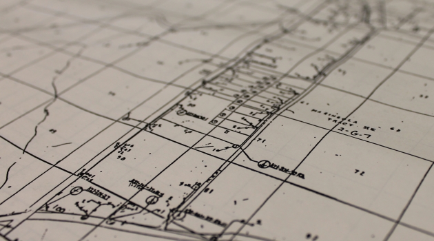
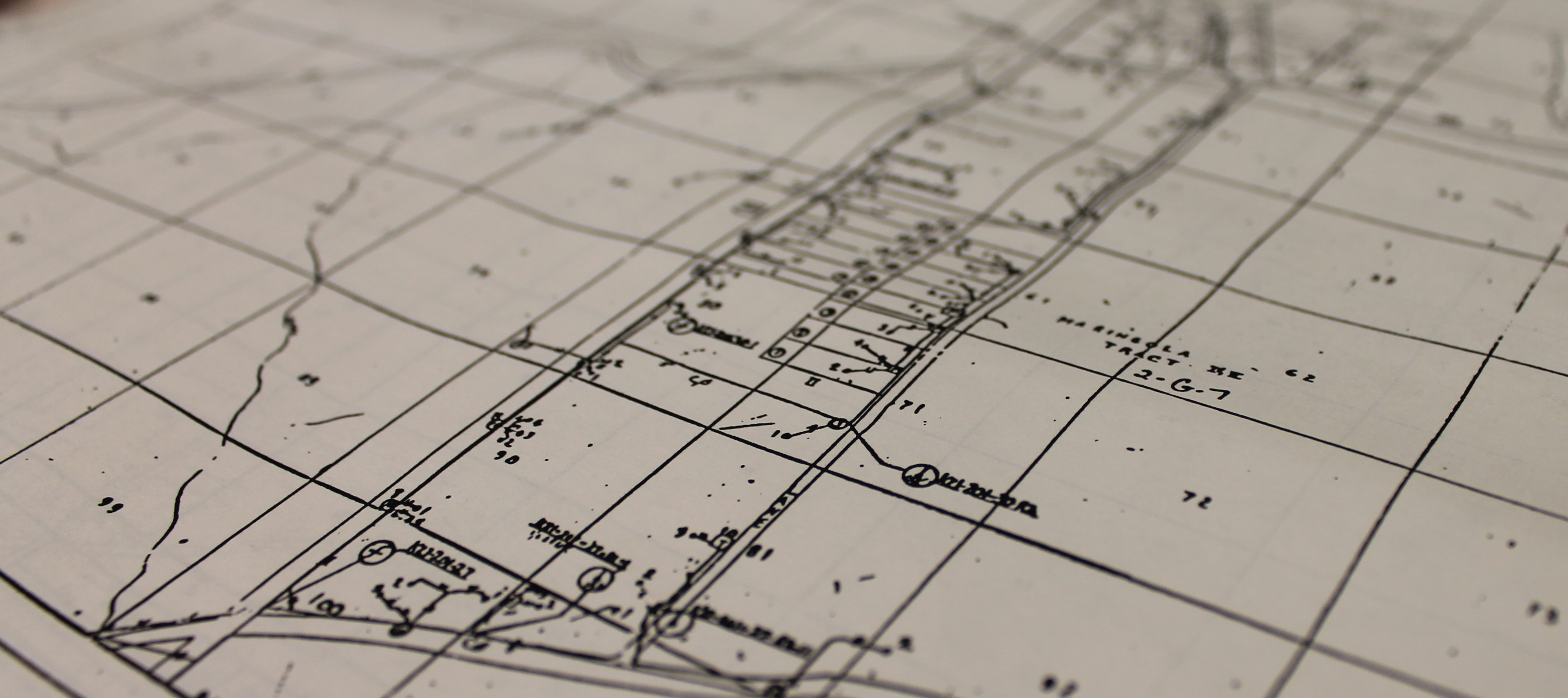
“The map”, as it is referred to, is the whole picture – from current to completed work orders, to the locations of GPS – pinpointed materials, it shows it all. That’s where Docca and his team come in. It is their job to oversee, add, and correct changes made to the map to ensure it is as up-to-date and accurate as possible for its daily use by Co-op employees.
“We validate that work, not only from a connectivity standpoint, but to make sure it has all the proper construction units, and everything is in the right location. We approve that work, and it becomes a part of the map,” Docca says.
To call the work GIS does “complex” would be an understatement, but with the advent of mapping technology, it has become increasingly easier to maintain. When Docca started in GIS, technicians were still creating hard-copy, paper maps organized in map books, which crews and engineers would take out into the field with them to jobs. The major issue with this system of mapping was that often, the maps being referenced were only updated once a year. In an effort to upgrade that existing system, the Co-op switched to a combination workflow in 1999, which still utilized paper field maps, but also incorporated AutoCAD technology. While an improvement, the system presented its own set of challenges, the most important being that details of the maps could be lost from format to format, from user to user. That’s when it became clear to Docca that there was still room for improvement.
“We saw the need to expand and use something that was more global, and more industry standard, which was called Esri. That is the global standard for mapping and GIS,” Docca says. “We went with a third-party vendor that uses the Esri platform, but they deliver a specific tool set for the electric industry.”
For input on selecting this new, completely digital system, Docca organized meetings with employees from various departments to get a balanced understanding of what would benefit the Co-op as a whole.
“I took thirteen different people from the Co-op that all used the map in a different capacity. I had engineers, dispatchers, meter readers, locators, linemen, managers – you name it, I had them in there,” Docca says. “And we all sat at the table, and we met regularly, and we had all the different vendors come out.”
Eventually, the decision was made to work with Futura, the company who has been providing DEC with its GIS software for almost a decade. Futura’s software capabilities allow for the creation and maintenance of the map to be a collaborative effort between the departments that use it, an essential feature when you consider the size of DEC’s workforce and the number of departments a work order can go through before it comes to GIS. According to Geospatial Technician Heather Wilkerson, it can be a long process. Generally, a work order begins in the New Service department, then moves on to Engineering, where it is designed before being authorized by Operations. Once it’s approved, the linemen build and install the finished product. Its final stop is GIS.
“The linemen will go out and build the job, and once all that’s done, the job is closed and then it comes to us. We’re kind of the last step,” Wilkerson says.
Geospatial Technician Brenda Quillen says the work of GIS is to update the map to reflect the work that has been completed. This enables employees in the field to have an accurate representation of various jobs that might impact their work in real time.
“What we do is we get the work order and put it on the map from what staking did and what operations did,” Quillen says. “We open our map every morning, and it has all of our jobs in there. And so, that’s what the field engineers have done, as far as staking it, and then operations builds it and dispatch puts the necessary information in for it to come to us electronically. And then we just take the jobs and post them to the map.”
Both Wilkerson and Quillen came to GIS after working in other areas of the Co-op, which proved to be a major asset when working in mapping.
“We both bring knowledge from a lot of different departments,” Wilkerson says. “And it makes it nice, because there’s a lot of things, between the two of us, we can figure out.”
The nature of work in most of the departments at Delaware Electric lends itself to collaboration, but the scope of effect GIS has on the efficiency and success of the Cooperative in its entirety makes their collaboration a necessity. The map serves as the guide, the GIS team its curators. Working together, they set the Co-op on the path to it’s true north: keeping the lights on.